NYC Very Warm To Hot Weather Continues
Good early morning everyone. Our cold front passes through today with little fanfare, taking most of its energy well north of us, and will only result in a wind shift & slightly less humid weather temporarily. We’ll be in this pattern until late Sunday/Monday, and we may extend the upper 80’s into Monday depending on the timing of our front.
SATELLITE

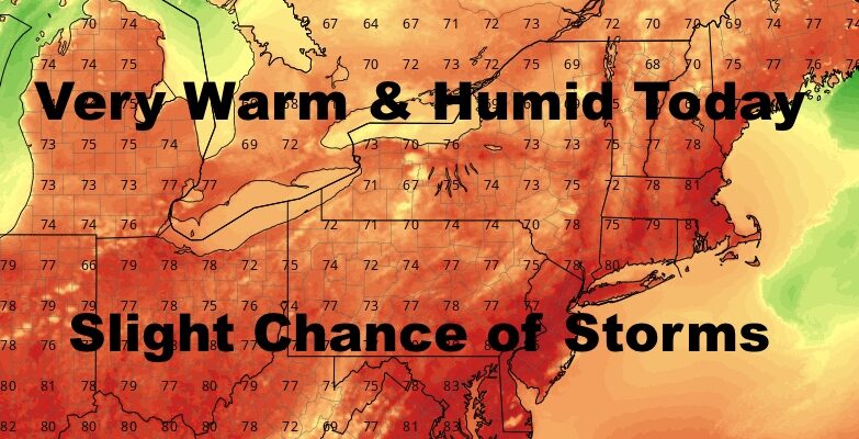
Showers and storms are moving well north of the area, but we could still see some widely scattered pop-up action later on. It’ll be very warm and humid with highs in the upper 80’s to near 90.
REGIONAL RADAR

Tomorrow we cool off a tad, and the southerly flow doesn’t quit for very long. I was hoping for a full day of WNW winds, but that southerly flow may return by late day. Highs tomorrow in the mid to upper 80’s.
On Friday, we’re already back to near 90 conditions, and humidity will begin to creep up again.
LOCAL RADAR NEW YORK CITY

Expect near 90 conditions to continue through the weekend, with a slight chance of storms Sunday as that front slowly drifts our way.
LOCAL RADAR PHILADELPHIA


With the front moving so slowly, we’ll hold off on calling Monday as far as temps, but we know lower 80’s returns for Tuesday. “Cooler” weather will prevail for a few days, then we could get into warmer temps by July 4th .
MANY THANKS TO TROPICAL TIDBITS FOR THE USE OF MAPS
Please note that with regards to any tropical storms or hurricanes, should a storm be threatening, please consult your local National Weather Service office or your local government officials about what action you should be taking to protect life and property.