NYC Warm Conditions Rush Into Metro Area
Good morning everyone. The warm dome of air has drifted over the area and we’re in for some really beautiful conditions over the next few days. Things cool off on the weekend though, and I explain below why.
SATELLITE

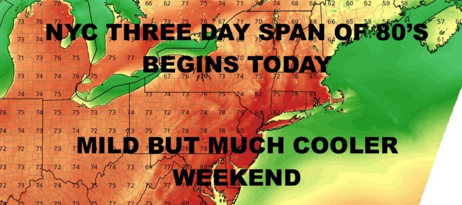
We’ll keep things simple since this is a very simple forecast. Steady WNW winds today will help create that fast-warming sinking air we given the right conditions in March and April sometimes. As it normally does, it’ll help boost temps quickly and into the near 80/low 80 range for today.
We go even warmer tomorrow with lighter winds, sunshine stays, and we’ll have highs in the low to mid 80’s (cooler at the shore and east end).
WEATHER RADAR

Friday is a carbon copy day with more low mid 80’s, but we’ll increase the humidity a bit. Clouds will increase on Saturday with the slight chance of showers, and temps will drop into the 70-75 degree range.
Expect more clouds and the chance of some scattered showers Sunday with highs in the mid to upper 60’s.

BE SURE TO DOWNLOAD THE FREE METEOROLOGIST JOE CIOFFI WEATHER APP &
ANGRY BEN’S FREE WEATHER APP “THE ANGRY WEATHERMAN!
MANY THANKS TO TROPICAL TIDBITS & F5 WEATHER FOR THE USE OF MAPS
Please note that with regards to any severe weather, tropical storms, or hurricanes, should a storm be threatening, please consult your local National Weather Service office or your local government officials about what action you should be taking to protect life and property.