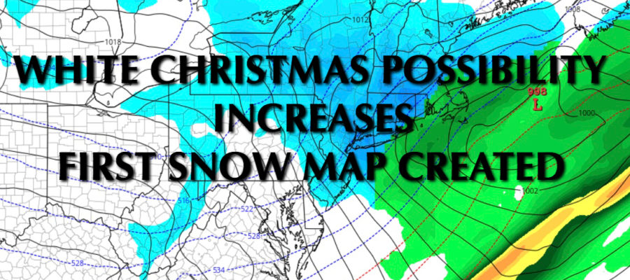
NYC WHITE CHRISTMAS POSSIBILITY INCREASES

NYC WHITE CHRISTMAS POSSIBILITY INCREASES
NYC WHITE CHRISTMAS POSSIBILITY INCREASES – Good morning everyone! We’re only a few days away and everything continues to point towards the possibility of a White Christmas with a light snow accumulation possible.
First, we’ll have part 1 of our system heading our way, which will be all rain. Cloudy skies, east winds, and mid 40’s will be on tap today; with the slight chance of some light rain or drizzle. The chance of steady rain will be with us later this evening all the way into tomorrow night. We should be able to pull off 1-2” of rain before we get partial clearing and low 40’s on Sunday.
Snow Map
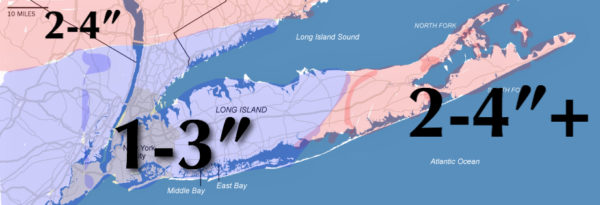
Here is my initial snow map for this event. Some adjustments will probably need to be made, especially for the east end of Long Island as we wait to see how robust our departing wave is; if robust at all. However, this is what I see as of this very moment and if things were to hold steady.
The setup I’ve been talking about for pretty much a week, remains the same. I still believe we’ll have a rain changing to snow situation very late Christmas Eve as a wave rides along the old front and we wait for cold air to work its way in. This will cut down on the accumulation and also hold the largest accumulations to grass, cars, trees, and other colder surfaces. Any snow that does fall, also looks to end by early morning Monday.
Basically, it’ll make for a pretty scene, while not destroying a big travel day. Stay tuned as we continue to watch the big story for Christmas, and the buzz brewing for a larger storm next week.


NATIONAL WEATHER SERVICE SNOW FORECASTS
LATEST JOESTRADAMUS ON THE LONG RANGE
GET ANGRY BEN A NICE CIGAR!

Weather App

Don’t be without Meteorologist Joe Cioffi’s weather app. It is really a meteorologist app because you get my forecasts and my analysis and not some automated computer generated forecast based on the GFS model. This is why your app forecast changes every 6 hours. It is model driven with no human input at all. It gives you an icon, a temperature and no insight whatsoever.
It is a complete weather app to suit your forecast needs. All the weather information you need is right on your phone. Android or I-phone, use it to keep track of all the latest weather information and forecasts. This weather app is also free of advertising so you don’t have to worry about security issues with your device. An accurate forecast and no worries that your device is being compromised.
Use it in conjunction with my website and my facebook and twitter and you have complete weather coverage of all the latest weather and the long range outlook. The website has been redone and upgraded. Its easy to use and everything is archived so you can see how well Joe does or doesn’t do when it comes to forecasts and outlooks.
Just click on the google play button or the apple store button on the sidebar for my app which is on My Weather Concierge. Download the app for free. Subscribe to my forecasts on an ad free environment for just 99 cents a month.
Get my forecasts in the palm of your hand for less than the cost of a cup of Joe!