Rain Lovers Ducks Noah Rejoice
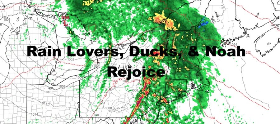
Good morning everyone. If you look outside, you’ll notice it’s raining. That’s going to pretty much be your view today as a fairly vigorous system crosses the area. Things are looking up tomorrow, then we kind of sputter along in Halloween where things are not looking good at all. Cool air also remains delayed and we’ll have to wait for next weekend for a taste of that.
SATELLITE

Look for rain to continue to today with breezy/windy conditions. The rain we’re getting right now is of the light variety well ahead of our cold front. As that cold front nears, expect heavier and gustier showers, with some rumbles of thunder possible. With the prolonged ocean fetch of wind, some minor coastal flooding is possible. We may also see some localized street flooding during times of heavy rain in poor drainage areas. Highs today will be mid 60’s
REGIONAL RADAR

We clear out tomorrow with sunny skies, light winds, and low to mid 60’s, but clouds creep in again on Tuesday with a maritime flow. Expect a slight chance of light showers with more clouds than sun on Tuesday.
On Wednesday, we clear out once again and back with seasonably mild temps in the mid to upper 60’s, but another system looms for Halloween and into Friday.
LOCAL RADAR NEW YORK CITY

On Thursday, another system similar to strength and origin of today’s system, will gather and head our way. It’s possible we could hold off on the rain for most of the day, but it’ll probably make its way on for trick or treating in the evening.
Any rain will start off light first, then increase in intensity as the cold front nears. The bulk of the rain looks to be on Friday, with the system not clearing out till afternoon/evening.
LOCAL RADAR PHILADELPHIA


As far as our cool air, everything holds off until the weekend. Low to mid 50’s are possible on Saturday, and we could see some 20’s and 30’s overnight.
MANY THANKS TO TROPICAL TIDBITS FOR THE USE OF MAPS
Please note that with regards to any tropical storms or hurricanes, should a storm be threatening, please consult your local National Weather Service office or your local government officials about what action you should be taking to protect life and property.