Today’s NYC Forecast Holding Strong With Afternoon Snow To Rain Late
Good morning everyone. As stated yesterday, watching the radar and how that swath of moisture interacted with the dry air was the most important thing at this point in the game; and I wake up this morning rather unimpressed. After all is said and done, this is a minor event for our area and always was in my eyes, but we’ll continue to watch everything for any slight “surprises”.
SATELLITE

Clouds have blanketed the area ahead of our warm front and we should expect snow coming into the area some time late morning to early afternoon. At this point, we should be cold enough for it to stick almost everywhere, but we’ll be getting to the freezing mark around 4pm and rise from there.
REGIONAL RADAR

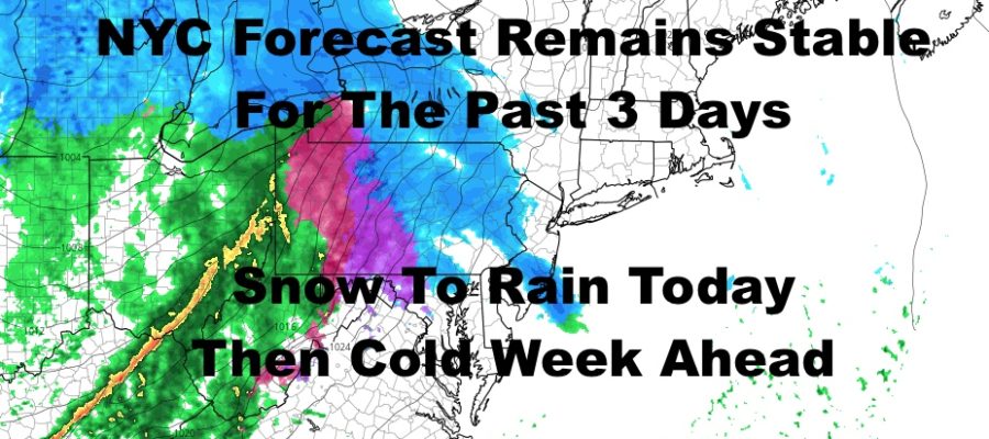
The ingredients are there, but the radar remains unimpressive to me. This arm of moisture coming through central PA and eventually into our area, was crucial in terms of modeled snowfall and other social media outlets. This was the one that was supposed to “dump” 2-4″ before letting the rest of the system do its thing.
Right now it’s looking very narrow and anemic, so I’m sticking to my forecast of a trace to 2″ for the NYC area and Long Island, and 2-4″ just N&W of NYC and into NJ and upstate NYC. South facing shores of Long Island and extreme eastern Suffolk will probably see the lower end of this spectrum, and the best chance to reach the top or slightly exceed, will be Manhattan, The Bronx, and the north shores of Nassau and western Suffolk. Unless the radar impresses me later through, we’ll stick to that general trace – 2″/2-4″ formula for the listening area.
LOCAL RADAR NEW YORK CITY

Snow changes to a mix and/or plain cold rain by late evening, and we rise through the 40’s overnight. If we don’t get any upside surprises, the 40’s overnight and into tomorrow should take care of whatever’s on the ground for NYC & Long Island. Look for a sunny and breezy day tomorrow, with highs peaking in the low 40’s early, then slowly dropping before sunset.
Lows overnight tomorrow will sink back into the 20’s, then we have a cold start to the week with near 30 temps as highs and upper teens overnight.
LOCAL RADAR PHILADELPHIA


MANY THANKS TO TROPICAL TIDBITS FOR THE USE OF MAPS
Please note that with regards to any tropical storms or hurricanes, should a storm be threatening, please consult your local National Weather Service office or your local government officials about what action you should be taking to protect life and property.