Typical NYC August Weather Continues
Good morning everyone. We have a lot of little stuff going on in the NYC area, which is typical for this time of year as we start to pivot towards September; but what is also typical is that all of this little stuff and variations, essentially add into nothing.
SATELLITE

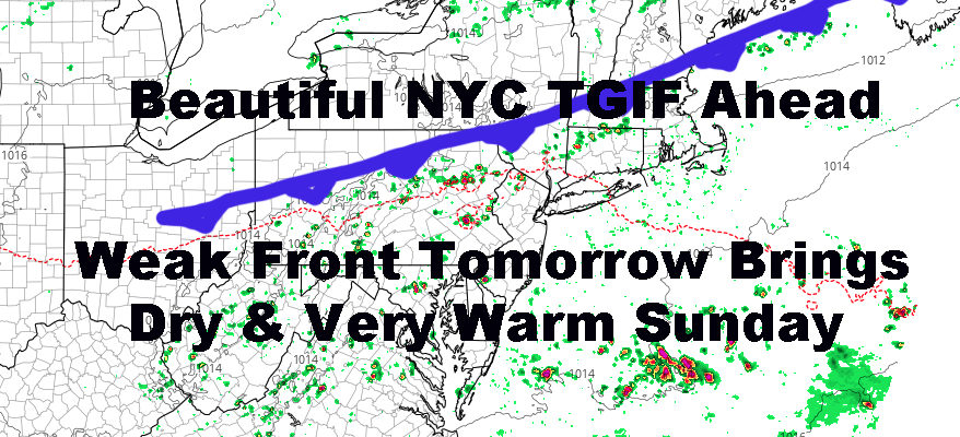
For today, we’ll have decreasing clouds as a front sinks south of the area. This one had no impact and most of the moisture associated with it is well to our south. Look for a sunny day as we head towards late morning, with highs in the mid 80’s.
REGIONAL RADAR

Tomorrow, another front will pass and be slightly more energized, but it’ll be weak nonetheless. Clouds may keep the temps minimized into the mid 80’s, but we could see a few scattered upper 80’s dot the area in spots that get extra sunshine. We’ll also have the slight chance of a thunderstorm ahead of this front, but action will be scattered and mostly away from the coast. Any storm that does pop up, has the chance to be locally severe as we are in August.
For Sunday, that front passes by and helps make us drier than previously expected humidity-wise, but doesn’t do anything to cut the warmth. In fact, a light NW flow will help warm us up quickly and nicely, with upper 80’s to near 90 throughout the area. This warmth should go all the way to the beaches to make for a fine beach day.
LOCAL RADAR NEW YORK CITY

From Monday onward, we dial up the humidity slowly, and keep temps in the very warm range with mid to upper 80’s through the week. Mid to late week, a front will start interacting with the area, and we’ll increase the chance of showers and storms.
Any true relief will be slow to occur, and we could wind up with a very warm and humid late week/early weekend next weekend as well, with afternoon, summer-variety thunderstorms possible.
LOCAL RADAR PHILADELPHIA


In the long range, I still believe the models aren’t handling it well, so I’m going to hold off on calling for any prolonged, cool blasts that send us into an early fall long before September arrives.
MANY THANKS TO TROPICAL TIDBITS FOR THE USE OF MAPS
Please note that with regards to any tropical storms or hurricanes, should a storm be threatening, please consult your local National Weather Service office or your local government officials about what action you should be taking to protect life and property.