Windy NYC Thanksgiving Tomorrow Eyes On Late Weekend Continue
Good morning everyone. We have a showery and cloudy day in store for us today, and that’ll represent much cooler air moving in eventually. It’ll take some time getting in, but not before we have a windy day for Thanksgiving tomorrow. Meanwhile, we still have our eyes on the next system for late weekend, and I continue to not be impressed as far as frozen precipitation prospects for the NYC/Long Island area.
SATELLITE
Look for a generally cloudy day today, with some showers moving in mid to late morning. Most of the action will be scattered, and we’ll see that chance go through the evening and into tonight. The cold front passes through later on and winds will pick up, but the coolest air lags until Friday.
REGIONAL RADAR
That wind really picks up tomorrow, and again, there could be issues with the balloons for the parade tomorrow. Expect highs in the upper 40’s to near 50, but it’ll be chilly and blustery for the parade in the morning. Winds will be in the 20-25mph realm, with gusts to near 40.
LOCAL RADAR NEW YORK CITY
On Friday, we’ll dial back the wind to a steady northerly flow, but the core of the chilly air heads in. Expect sunny skies and highs in the low to mid 40’s.
Sunny skies continues Saturday morning and we may not get out of the low 40’s, then clouds will increase late with our next system heading in Sunday AM.
LOCAL RADAR PHILADELPHIA

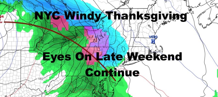
For Sunday, a broad area of low pressure/frontal system approaches us from our west via the Great Lakes. Eventually, it’ll transfer its energy to or near the coast and enhance our precipitation. Before that, we could see a very brief taste of wet snow or a rain, sleet, snow mic as the first batch of precipitation runs into some cold air from Saturday night.
As of this moment, if we see any frozen precipitation at all, I think it it goes to a plain, cold rain very quickly. Depending on where our secondary low forms and becomes the primary, will dictate if we see any frozen precipitation on the back end. Again, I’m not very impressed and this whole thing may end up being an all rain event for the NYC/Long Island area aside from that brief onset mix. Even if it’s not all rain, at this point, I do not see anything major as far as accumulation for our area.
We’ll watch it closely for any changes, so stay tuned as we sort out the timing, strength, and path.
MANY THANKS TO TROPICAL TIDBITS FOR THE USE OF MAPS
Please note that with regards to any tropical storms or hurricanes, should a storm be threatening, please consult your local National Weather Service office or your local government officials about what action you should be taking to protect life and property.


