Coastal Low Expected Friday Bringing Gusty Showers & Storms To NYC
Good morning everyone. We continue to have a lot of subjects to cover forecast-wise, with a multitude of stories, including the start of a possible heatwave late next week. Today and tomorrow will be no slouch in the heat department, but then low pressure rising up the coast will suppress temps slightly with clouds and heavy showers & storms.
SATELLITE

Expect morning clouds today, then a mix of sun & clouds. We’ll keep the slight chance of a shower or storm in the area, and we’ll go for 90 degrees today. Look for the beaches to be slightly cooler, and some parts of downtown Brooklyn and Central Queens may squeak past 90.
Tomorrow will be the hottest day of the week, as we dry out the atmosphere just enough to get some extra sunshine and no storms in the area. It’ll still be very humid though, and expect low to mid 90’s throughout the area.
REGIONAL RADAR

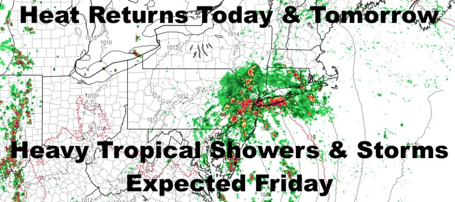
For Friday, a compact area of low pressure that’ll work the grey areas between tropical, sub-tropical, and non-tropical, will head up the coast and bring with it on & off heavy showers and storms. At this point, it doesn’t matter how it’s categorized because it won’t change the forecast for any better or worse.
Any showers that do move in will bring gusty winds to the surface, and any storms in the area could spawn a few waterspouts along the south shore and Long Island Sound. Rain will be Florida-like big drops, and that may cause some flooding in poor drainage areas.
Because of the low’s origin and very warm to hot air all around us, expect Friday to still be warm and very humid. Highs should be in the mid 80’s even with clouds and heavy rain lurking.
LOCAL RADAR NEW YORK CITY

We’ll still have the chance of some tropical showers and storms around on Saturday, but we begin to heat up again as the action becomes less numerous and sunshine increases a bit. Expect upper 80’s to near 90 Saturday with very humid conditions.
Upper 80’s to low 90’s stick around for Sunday, with the slight chance of a shower or storm.
LOCAL RADAR PHILADELPHIA


Into next week, we continue onward with upper 80’s to near 90/low 90 temps, but we are still keeping an eye on things some time between next Wednesday and Friday for the heat to get a little boost.
There’s still nothing set in stone, but the heat is building in the Midwest and wants to increase along the East Coast during that time period. If successful, mid 90’s to near 100 degree temps could pay a visit late next week and into early to mid following week.
This is something I’ve been watching for a while, and for those who don’t like the hot weather, thank that tiny low pressure for visiting Friday. Had Friday’s system not materialized, we could’ve been looking at 95-100 degree weather from this Friday through the week 20th.
MANY THANKS TO TROPICAL TIDBITS FOR THE USE OF MAPS
Please note that with regards to any tropical storms or hurricanes, should a storm be threatening, please consult your local National Weather Service office or your local government officials about what action you should be taking to protect life and property.