Flurries Today Light Snow Tuesday
Good afternoon everyone. As we speak, a light of snow squalls and rain showers are moving through in gusty fashion. This is the leading edge of our first push of cold air, which will be followed by an even stronger push behind our expected system late tomorrow night and Tuesday.
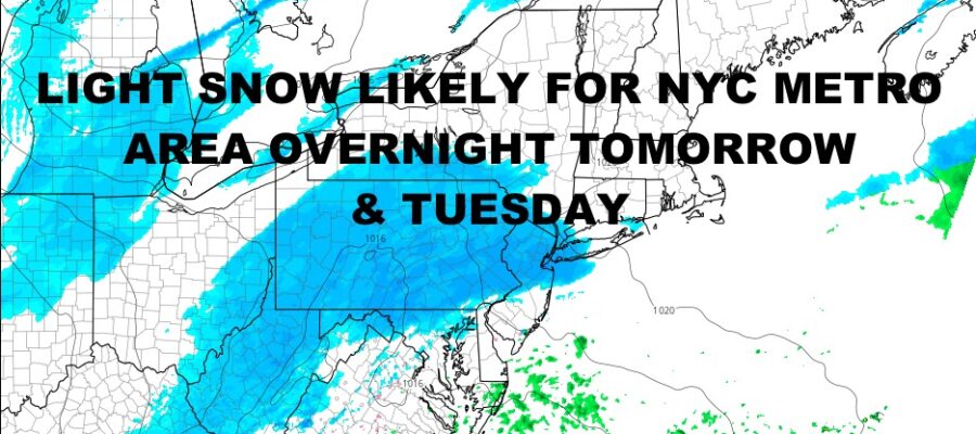
That one will bring an area of light snow to the Northeast and New England, possibly giving New York City their first measurable snowfall in quite some time. We’re not talking big amount here and never thought it would be. A few days ago we mentioned that this is a light to moderate event, with late development of low pressure well offshore. Things are holding true and this looks like it’s leaning towards the light event.
Depending on the latest weather models, the short range NAM shows snow changing to mix, then back to snow; while the GFS shows all snow. If development happens a few hours earlier, we could also see “bigger” amounts on the Forks of Long Island. For now, we are going to play this very conservative, with a trace to 2″ expected for NYC, and 1-4″ expected on the East End of Long Island depending on when that development happens. If low pressure kicks off a little earlier, then we can see 2-4″ out there.
Again, this is a light event, but “monumental” if it happens because it breaks the 700+ day “snow drought” for NYC. We’re also watching frigid air on the move, and possibly some more snow on Friday. This one has to chance to be more on the moderate side if things work out, but it’s too far ahead at this point. We’ll have to watch how Tuesday’s system does, and what’s behind it as far as cold air and where high pressure sets up.
Below is your local forecast –
SATELLITE

For today, clouds have arrive and temperatures are starting to fall from the 40’s into the 30’s. We’ll have gusty snow showers and rain showers, then we plummet temp-wise overnight. Look for lows 15-20 tonight.
WEATHER RADAR

We’ll have AM sun tomorrow, then increasing clouds late. We remain dry till late overnight, but on the cold side with highs in the upper 20’s to low 30’s. Light snow moves in before sunrise Tuesday, and lows will be low enough to support the sucking of anything that falls. Lows will be in the mid to upper 20’s.
Look for light snow, or light snow/mix changing back to all snow for Tuesday. Highs will be in the low 30’s, then dropping before sunset. Expect a trace – 2″ of snow. Anything an Ince or more, is considered measurable and will break the snow drought. Lows will be in the 15-20 range.

Wednesday is the coldest day of the week, with mid to upper 20’s as highs, then more upper teens to low 20’s overnight. Thursday relaxes a bit with low 30’s under increasing clouds. Friday we have the chance of some snow, but I’m holding off on that for a bit.
BE SURE TO DOWNLOAD THE FREE METEOROLOGIST JOE CIOFFI WEATHER APP &
ANGRY BEN’S FREE WEATHER APP “THE ANGRY WEATHERMAN!
MANY THANKS TO TROPICAL TIDBITS & F5 WEATHER FOR THE USE OF MAPS
Please note that with regards to any severe weather, tropical storms, or hurricanes, should a storm be threatening, please consult your local National Weather Service office or your local government officials about what action you should be taking to protect life and property.