HURRICANE JOSE SCENARIOS
HURRICANE JOSE SCENARIOS
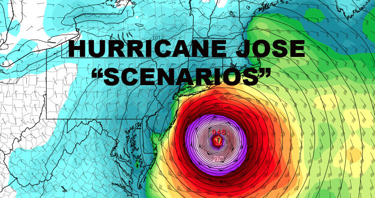
HURRICANE JOSE SCENARIOS – Good evening everyone. Jose is back to being a hurricane and models continue to take him too close for comfort in my book, especially when there are still a lot of questions only several days out.
As of 5pm, Hurricane Jose is looking more typical and healthy of a category 1 hurricane. He has winds of 75mph, gusts to 90, and continuing to forge ahead slowly at 10mph to the NW. Outflow is looking better and it looks as if an eye is trying to form in the center of some heavier convection.
Although there are differences between a Jose, and a Sandy, Irma, Harvey, or even an Irene, it still must be taken seriously; especially with it’s close approach during a new moon. For those that live on the water or are familiar with the ocean, the new moon and full moon give you the highest of high tides, and the lowest of lows. Timing is essential whenever a hurricane, tropical storm, or a Nor’easter approaches the area during these lunar periods.
I’ve put together a few scenarios of what to expect given several models IF Jose maintains it’s current strength. Obviously, adjustments would have to be made if there were an increase or decrease in Hurricane Jose’s power. Jose as of this moment is a very compact system, so any shift in course would mean drastic changes and the strongest winds experienced could be held to the coast and/or very localized depending on path. Remember, these are not official forecasts as of now, and are strictly used to paint a picture on what to expect if one of these scenarios happen.
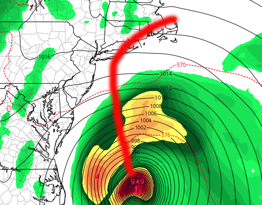
Scenario 1

Scenario 1 (least likely but definitely still in the cards as of now) – Jose cuts over through central or eastern Long Island. Depending on the arrival in terms of high tide, Jose could be capable of moderate flooding in areas that flood during a bad nor’easter. That would mean certain areas of the north shore, Great South Bay, Freeport, Baldwin, northern (bayside/canals) sections of Long Beach, Gerritsen, Rockaway, and Broad Channel. While flooding wouldn’t be life threatening unless you put yourself in a situation, water damage would be possible in flood prone areas, including cars left on the streets in low lying areas. Beach erosion, extremely rough surf, and rip currents would be a given.
Strongest of winds, possible Tropical Storm strength and higher gusts would be felt the hardest along the immediate shore due to less friction, but stiff gale-force winds could topple some trees inshore due to the foliage acting like a sail. Power outages and minor damage would certainly be possible.
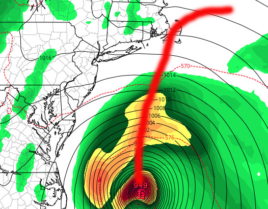
Scenario 2

Scenario 2 – Shift everything as far as effects to the east, with Cape Cod, Nantucket, and Martha’s Vineyard taking a pounding. Same thing as far as treated like a bad Nor’Easter and the new moon being a concern. Areas such as Newport, RI could see some minor/moderate flooding due to Jose, specifically along the tourist areas of the docks/shops. Long Island would still see a chance of some minor/almost moderate tidal flooding, especially in flood prone areas; with a chance of a very stiff breeze and a few heavy showers.
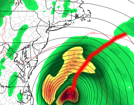
Scenario 3

Scenario 3 – We say goodbye to Jose and thank him for some great surf, a breezy day, and increased blood pressure.
We hope for scenario 3, but remind ourselves that 1 & 2 are still on the table. So while in the back of our heads, we keep “just” a bad Nor’easter in our thoughts, we respect Jose for what he is, a hurricane. We will be keeping an close eye and update if things change or it becomes time to put a plan into effect/what to expect exactly.
SATELLITE LOOP
LOCAL RADAR MIAMI FLORIDA
 GET JOE A CIGAR IF YOU LIKE
FiOS1 News Weather Forecast For Long Island
FiOS1 News Weather Forecast For New Jersey
FiOS1 News Weather Forecast For Hudson Valley


