LAST DAY OF NYC SUMMER BEFORE SPRING BEGINS 
LAST DAY OF NYC SUMMER BEFORE SPRING BEGINS
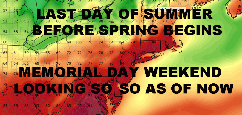
LAST DAY OF NYC SUMMER BEFORE SPRING BEGINS – Good morning everyone! Summer is with us for one more day before the cool-off begins. We’ll have hot and humid conditions, with temps in the low 90’s for the NYC area, 80-85 at the coast. With the cool air moving in as a front drapes down across the area, we’ll have a light chance of an isolated thunderstorm. Most of the energy will be going to our north/northeast, but the chance is there regardless. Anything that does pop up, has the potential for some small hail, gusty winds, torrential downpours, and frequent lightning. For those who like to take photos of storms at night, you may have another shot at some good photos looking north across the Long Island Sound.
For the weekend, we’ll have breezy and sunny conditions, highs in the mid 60’s to near 70. Slightly warmer air returns ahead of a system for Monday, but we’ll have some rain in the area along with the low 70’s temps. Sun returns for Tuesday and we could have a stiff breeze, highs in the mid 70’s. We’ll wait on any wind speed forecasts for Tuesday as we wait and see what Monday’s system does and how it departs.
Average highs through late May are in the low to mid 70’s, and we should be at or just slightly below normal through an extended period. So spring returns along with a few spring-like systems along the way into the first week of June. Memorial Day Weekend is looking so-so, with normal temps but the chance of some periods of rain depending on the timing and speed of something that’ll be in the area +/- 2 days.
Satellite View

LAST DAY OF NYC SUMMER BEFORE SPRING BEGINS – A cold front, clearly visible, is heading down from our north/northwest and might bring a few scattered storms along with it. What is certain is the cool air it’ll bring for the weekend. Severe weather sadly continues in the midwest, but ’tis the season.
Northeast Radar
Radar is quiet for now, but should light up later in the day as scattered storms dot the area, especially north of the NYC area, but one or two could sneak in.
FiOS1 News Weather Forecast For Long Island
FiOS1 News Weather Forecast For New Jersey
FiOS1 News Weather Forecast For Hudson Valley
NATIONAL WEATHER SERVICE SNOW FORECASTS
LATEST JOESTRADAMUS ON THE LONG RANGE
Weather App
Don’t be without Meteorologist Joe Cioffi’s weather app. It is really a meteorologist app because you get my forecasts and my analysis and not some automated computer generated forecast based on the GFS model. This is why your app forecast changes every 6 hours. It is model driven with no human input at all. It gives you an icon, a temperature and no insight whatsoever.
It is a complete weather app to suit your forecast needs. All the weather information you need is right on your phone. Android or I-phone, use it to keep track of all the latest weather information and forecasts. This weather app is also free of advertising so you don’t have to worry about security issues with your device. An accurate forecast and no worries that your device is being compromised.
Use it in conjunction with my website and my facebook and twitter and you have complete weather coverage of all the latest weather and the long range outlook. The website has been redone and upgraded. Its easy to use and everything is archived so you can see how well Joe does or doesn’t do when it comes to forecasts and outlooks.
Just click on the google play button or the apple store button on the sidebar for my app which is on My Weather Concierge. Download the app for free. Subscribe to my forecasts on an ad free environment for just 99 cents a month.
Get my forecasts in the palm of your hand for less than the cost of a cup of Joe!


