NYC Cold Air Modifies Quickly
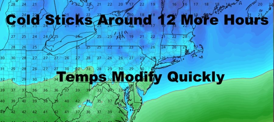
Good morning everyone. We have a very cold start to the morning today and things won’t be warming up much. However, milder air is already on the move, and we’ll see some changes overnight. We still have no snow on the immediate horizon, but the end of February and start to March continue to look possibly colder than average.
SATELLITE

Sunny skies, calmer winds, and dry conditions rule the area today. It’ll also be below average temp-wise, with highs in the low 30’s throughout the NYC metro area.
Clouds increase tonight and temps barely dip at all. We’ll lose maybe a degree or 2, which is a sign that our cold air is gone.
REGIONAL RADAR

We’ll have sun and clouds tomorrow, and those clouds represent the milder air coming in. Expect highs in the mid 40’s and dry conditions.
LOCAL RADAR NEW YORK CITY

To start the week, Washington’s Birthday is looking sunny and comfortable, with highs in the mid to upper 40’s.
Clouds increase Monday night with our next system moving in, then rain is knocking on our door by late morning/early afternoon Tuesday. It’ll be a cloudy and showery Tuesday afternoon, with highs in the upper 40’s to near 50.
LOCAL RADAR PHILADELPHIA


We rinse and repeat Wednesday as skies slowly clear and cooler air heads in. Expect a relatively cool Wednesday through Friday with highs in the mid to upper 30’s; then 40’s may return for Saturday with a nice block of dry weather after Tuesday’s rain.
MANY THANKS TO TROPICAL TIDBITS FOR THE USE OF MAPS
Please note that with regards to any tropical storms or hurricanes, should a storm be threatening, please consult your local National Weather Service office or your local government officials about what action you should be taking to protect life and property.