NYC Coldest Air So Far This Season Expected
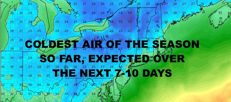
Good morning everyone. We continue to watch the push and reinforcing shots of cool to chilly air over the course of the next few weeks. Tomorrow will be the first push and will make for a chilly Halloween night and a chilly/cool Wednesday. Temps are expected to modify afterwards and a beautiful weekend is expected, then we drop again and this one could give parts of the NYC Metro Area their first freeze overnight next week.
We’re also watching the prospects for a larger system some time in the 2nd week of November, but it’s too early to tell what form this system comes in. Regardless, we find ourselves on the near-average to below average realm temp-wise for the first half of the new month.
SATELLITE
For today, look for lingering clouds, fog, drizzle, and gloom. We’ll have highs in the 55-60 range, then cooler air moves in overnight with partial clearing. Lows shouldn’t drop past 40 with clouds acting as a blanket.
Expect increasing sunshine tomorrow, with highs in the near 50/low 50 range. Overnight, we go chilly with lows in the mid to upper 30’s.
WEATHER RADAR
Wednesday is the coolest of the bunch, with highs ranging from chilly to cool. Depending on your location, expect temps ranging from the upper 40’s to near 50. Overnight will also be the coldest of this airmass as we dip into the low to mid 30’s. Frost is likely in spots, especially away from NYC proper.
Thursday we begin to modify with low 50’s, but we still dip back into the 35-40 range overnight. Look for more sunshine and 55-60 degree temps on Friday.
As stated before, your weekend is looking really nice, with sunshine and 60-65 degree temps. It’s a quick visit though by the mild air, because by Monday we’re back into the 50-55 degree realm; and possibly not making it out of the 40’s by next Wednesday.
BE SURE TO DOWNLOAD THE FREE METEOROLOGIST JOE CIOFFI WEATHER APP &
ANGRY BEN’S FREE WEATHER APP “THE ANGRY WEATHERMAN!
MANY THANKS TO TROPICAL TIDBITS & F5 WEATHER FOR THE USE OF MAPS
Please note that with regards to any severe weather, tropical storms, or hurricanes, should a storm be threatening, please consult your local National Weather Service office or your local government officials about what action you should be taking to protect life and property.


