NYC Dry Conditions Reign
04/25/24 11:00am ET
Good morning everyone. We continue to watch the prospect for more severe weather in the Midwest as our next system coming out of the Rockies moves very slowly to the east. Meanwhile in the Northeast and Southeast, quiet and dry conditions reign; with much milder air setting up for a visit Sunday through Wednesday.
Our severe weather situation in the Midwest is very complicated and fluid. As of this moment, we have a broad area of showers and thunderstorms from southeast Nebraska, eastern Kansas, western Missouri, and down into Arkansas. While there are no severe storm warnings or watches at this time, we will watch this area of moisture become more intense with the heating of the day and a reinforcing shot of energy ramming into it. Look for isolated severe weather, including the risk of large hail and isolated tornadoes. As of now, the risk is flooding rains as echos move slowly over the same areas.
After this batch, we will closely watch the radar for multiple lines of severe weather and isolated clusters of severe weather developing some time later this evening in western parts of Kansas, Nebraska, and South Dakota. As this new wave of low pressure begins to move, more lines will develop as our western line heads into eastern parts of Kansas. Look for powerful storms to develop in or near the Texas Panhandle and parts of Oklahoma, then race east as they max out on the cloud tops.
Look for very large hail associated with these multiple areas of severe weather, including damaging straight-line winds, and the risk of tornadoes. The timeline on this action looks to be between approx. 7pm today and 12pm tomorrow from west to east. Areas such Dallas/Ft Worth, Oklahoma City, Tulsa, Wichita, and Topeka, could get in on this action as violent storms trudge east. Please listen to your local agencies for watches and warnings that’ll begin to pop up tonight and the overnight hours.
Here is your local NYC Metro forecast –
SATELLITE

We’ll have some morning clouds today, then PM sunshine and very cool conditions. Highs will be an unseasonably cool/chilly 50-55 degrees. Things modify a bit tomorrow, but we remain on the cool side with sunshine and near 60 temps.
WEATHER RADAR

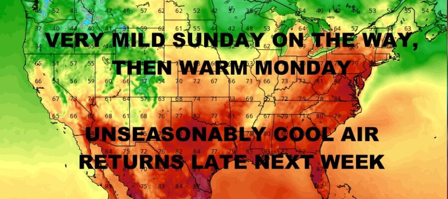
Near 60 temps and a mix of sun & clouds stick around for Saturday, then we break out into spring in a big way on Sunday. Clouds & sun remain, but look for mid 70’s in the area.

Monday is the warmest of the bunch with near 80 degree temps, then we retreat back into the 70’s Tuesday and Wednesday. Next shot of chilly air arrives Thursday and Friday as we struggle to reach 60.
BE SURE TO DOWNLOAD THE FREE METEOROLOGIST JOE CIOFFI WEATHER APP &
ANGRY BEN’S FREE WEATHER APP “THE ANGRY WEATHERMAN!
MANY THANKS TO TROPICAL TIDBITS & F5 WEATHER FOR THE USE OF MAPS
Please note that with regards to any severe weather, tropical storms, or hurricanes, should a storm be threatening, please consult your local National Weather Service office or your local government officials about what action you should be taking to protect life and property.