
NYC Gusty Showery Thundery Conditions Approach Thursday
Good evening everyone. We have a beautiful day finishing up here in NYC, and we should expect another fine day tomorrow. A cold front will be approaching from the west on Thursday, touching off some hefty storms inland during the afternoon hours. It won’t be a big airmass difference increasing the risk for severe weather, but more of a combination of low pressure spooling up in Canada and that front digging down into the Gulf and pulling up some tropical moisture. After that, we go fairly quiet, but the much cooler air takes its time getting in.
SATELLITE

Tonight will be fairly quiet and mild with lows in the 50-55 range. We’ll repeat today’s weather tomorrow, but with a more southerly and slightly more humid component. Expect highs in the near 70/low 70 realm.
WEATHER RADAR

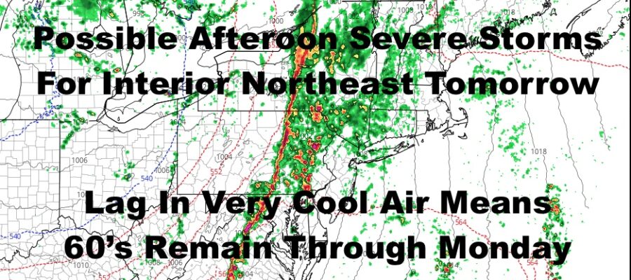
Clouds will increase tomorrow night, with some widely scattered and brief showers developing by sunrise into Thursday late morning. As the day wears on, we will be watching a line of storms developing in Central PA and NY. Those will march eastward, but we’ll have to watch the timing of the front to see if they can hold onto some energy. At minimum, the interior northeast has a decent shot at seeing some severe weather, with the biggest threat being damaging winds. We’ll see if they can hold onto some juice as they enter the picture here some time between evening and later on in the night. Highs will be a humid and breezy near 70/low 70’s.
The front should make it all the way through by Friday, so we can expect increasing sunshine, drying out, and highs near 70 again.

We dip a little bit temp-wise on Saturday with highs in the mid 60’s, but we’re almost back near 70 again on Sunday. We’ll have sunshine both days, with no prospect of rain again till next Tuesday. That should be our reinforcing shot of much cooler air, and temps may not get out of the 50’s. We’ll keep an eye on that, as well as a more active pattern developing overall.
BE SURE TO DOWNLOAD THE FREE METEOROLOGIST JOE CIOFFI WEATHER APP &
ANGRY BEN’S FREE WEATHER APP “THE ANGRY WEATHERMAN!

MANY THANKS TO TROPICAL TIDBITS & F5 WEATHER FOR THE USE OF MAPS
Please note that with regards to any severe weather, tropical storms, or hurricanes, should a storm be threatening, please consult your local National Weather Service office or your local government officials about what action you should be taking to protect life and property.