
COUPON CODE SUMMER24 GET 10% OFF
(Tempest is an affillate of Meteorologist Joe Cioffi & earns commissions on sales.)
NYC Humidity Begins Return
08/14/24 11:42am
Good late morning everyone. We have another beautiful day in the Northeast even though temperatures are beginning a slow rise into the warm category instead of “comfortably warm”. That being said, we are near average and on a good footing today until humidity and temps begin to creep up tomorrow.
Dewpoints in the low 60’s today will give way to muggier upper 60’s tomorrow as we return to upper 80’s, but a series of disturbances will knock the region back down this weekend into humid low 80’s. Those fronts sweeping by will be just enough to keep Hurricane Ernesto away from the East Coast, but due to its projected size and power, we will see some rough surf and rip currents as he passes by.
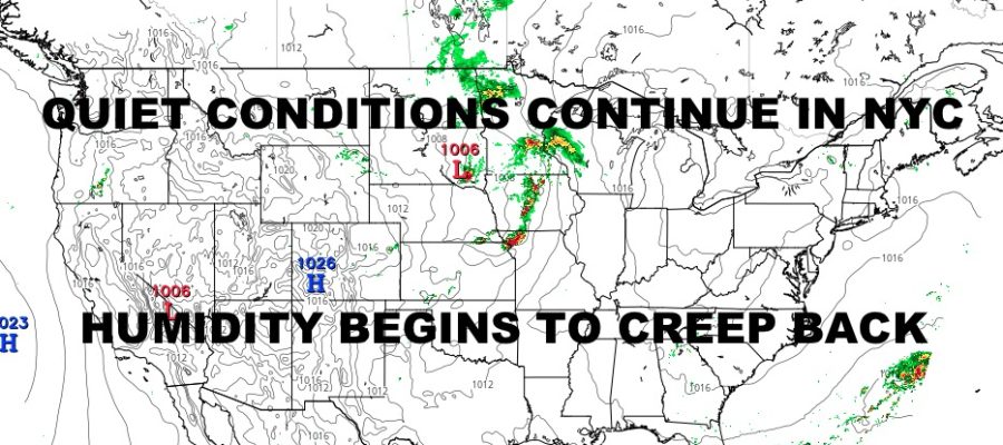
Our focus continues on the severe weather threat out in the Midwest, where we have broad & broken area of heavy showers and thunderstorms stretching from parts of North Dakota, South Dakota, Minnesota, Iowa, and all the way down into Missouri, Arkansas, and Mississippi. This is all energy riding the edge of a heat dome pushing itself to east and northeast. We will watch this activity continue, and see if a new and more dangerous line of storms develop later this afternoon and tonight.
The biggest concern right now is low pressure exiting out of the Rockies and into the upper plains. This energy will be bumping into that hotter and more humid air, sparking off scattered severe weather in North Dakota, South Dakota, Minnesota, and Wisconsin. We will be looking to see if a southern component organizes and forms into a vigorous line or two multi-directional lines of storms.
Yesterday we talked about the potential for some Derecho activity. While it is still possible, I believe that our current action prohibits or lessens the chance of that. However regardless of whether a Derecho forms or not, we are expecting widespread severe weather across parts of Iowa, Missouri, and Illinois; possibly clipping Nebraska and Kansas as things organize.
Look for very large hail, damaging winds, frequent lightning, torrential rain, and the possibility for some strong tornadoes. The timeline on this remains later today into the morning hours tomorrow. Here is your local NYC Metro forecast –
SATELLITE

Look for one more pleasant day today with slightly higher humidity and low to mid 80’s.
WEATHER RADAR

Tomorrow, humidity and mid to upper 80’s return with the slight chance of a PM shower or storm as all of that energy slides to the east. Friday looks more on the quiet side, but we remain humid with some upper 80’s.

The weekend brings extra clouds, more mugginess, and low 80’s with the chance of PM showers or storms Saturday; then a better chance of showers and storms on Sunday. Look for rough surf conditions starting some time between Friday and Saturday.
BE SURE TO DOWNLOAD THE FREE METEOROLOGIST JOE CIOFFI WEATHER APP &
ANGRY BEN’S FREE WEATHER APP “THE ANGRY WEATHERMAN!
MANY THANKS TO TROPICAL TIDBITS FOR THE USE OF MAPS
Please note that with regards to any severe weather, tropical storms, or hurricanes, should a storm be threatening, please consult your local National Weather Service office or your local government officials about what action you should be taking to protect life and property.