
Weather in 5/Joe & Joe Weather Show Latest Podcast
NYC Last Very Hot Day Ends With Scattered Storms
Good morning everyone. Today will be the last day of this mini heatwave before we get socked in with some clouds for the next 4-5 days. This will also be the hottest day of the stretch, and we could see some scattered severe weather to go along with it. Your weekend still looks questionable, and it’ll all come down to timing of precip at this point to see what activities you can get away with during the day.
SATELLITE

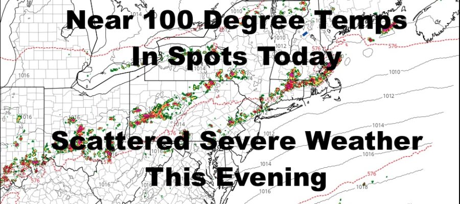
We start off today with lots of sunshine before cumulus clouds start to dot the sky. Those cumulus will build, especially to our WNW, and we should see a broken line of thunderstorms drift our way some time late afternoon/evening. Not everyone will see the action, but those that do could see some severe weather. When this type of heat breaks, torrential rain, frequent cloud-to-ground lighting, and strong winds are an easy thing for the atmosphere to pull off. Expect highs today in the mid to upper 90’s, and don’t be surprised if we see a 99 or 100 degree reading somewhere.
WEATHER RADAR

Tomorrow is a different animal as the cold front approaches our area. We’ll have variable cloudiness and the chance of on and off showers and storms at any point in the day. I do believe that there will be a more concentrated area of showers & storms pushing through during the afternoon/evening hours. As stated yesterday, this line may produce some localized flooding. We’ll also be watching to see if any of these storms reach severe limits. There’s not much talk on that right now anywhere else, but if a small wave forms along the front, pulling off severe weather won’t be much of a task. Highs tomorrow in the mid 80’s.
Moisture lags behind Friday and we go much cooler compared to the 90’s we see today. Look for variable cloudiness, scattered showers and storms, and highs in the mid to upper 70’s.

Your holiday weekend remains an issue as far as clouds, cool conditions, and some scattered showers. Right now it’s impossible to see the timing on any rain yet; plus, not everyone is going to see rain, so this makes for a tough forecast. Highs will be in the mid 70’s Saturday and mid to upper 70’s on your 4th of July.
BE SURE TO DOWNLOAD THE FREE METEOROLOGIST JOE CIOFFI WEATHER APP &
ANGRY BEN’S FREE WEATHER APP “THE ANGRY WEATHERMAN!

MANY THANKS TO TROPICAL TIDBITS & F5 WEATHER FOR THE USE OF MAPS
Please note that with regards to any severe weather, tropical storms, or hurricanes, should a storm be threatening, please consult your local National Weather Service office or your local government officials about what action you should be taking to protect life and property.