NYC Leftover Clouds Sprinkles Today
Good morning everyone. We have our departing system keeping clouds socked into the area for most of today with a few lingering sprinkles or scattered light rain showers. Forecast-wise for this system, we did fairly well. I stated the past few days that we would have both upside and downside surprises existing at the same time, and this rang fairly true. Most of the North Shore of Long saw the “best case” scenario play out, with many spots in the 3-5″ range. As you went out to Eastern Suffolk, many spots saw 2-3″. The South Shore came in lowest, with many coating – 2″ reports. Areas N&W of NYC saw a healthy 4-8″ dumping of heavy wet snow.
The shadiest of all counts was NYC itself, where the official number for Central Park was 1.8″. I find that very hard to believe, with many spots surrounding CP coming in with 2.5 – 3.5″ of snow: and it looks like someone is trying to force the record for lowest snow in a season.
SATELLITE
Clouds linger today with the chance of a few showers or sprinkles. We’ll have highs near 40, then lows dip to near freezing overnight, so watch out for some possible icy patches.
Sunshine returns tomorrow with mid 40’s for highs. That’ll help melt some of the snow, then we really get the melt going on Thursday. we’ll have some AM showers ahead of milder air, then a few blue breaks and highs in the low to mid 50’s. Originally we had said 55-60 for Thursday, but the snow will help keep temps down a few degrees.
WEATHER RADAR
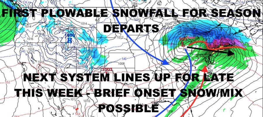
A vigorous system heading into the Great Lakes region (once again) pays a visit on Friday. Colder air tries to wedge itself in before the arrival and creates another overrunning setup for us. This time, whatever happens (if anything at all) will be brief in nature. As of snow we will call for the chance of a brief period of snow or mixed precip Friday, changing to a cold rain for the rest of the duration. Look for highs in the low 40’s.
Clouds linger on Saturday, then we’ll have some partial clearing late. Highs in the upper 30’s to low 40’s. Look for a mix of sun & clouds on Sunday with more upper 30’s to low 40’s.
In the long range we have nothing showing that makes me tingle, but we’ll be watching closely for any late-season surprises. After mid-March, this becomes very difficult as the gears of spring start to turn slowly.
BE SURE TO DOWNLOAD THE FREE METEOROLOGIST JOE CIOFFI WEATHER APP &
ANGRY BEN’S FREE WEATHER APP “THE ANGRY WEATHERMAN!
MANY THANKS TO TROPICAL TIDBITS & F5 WEATHER FOR THE USE OF MAPS
Please note that with regards to any severe weather, tropical storms, or hurricanes, should a storm be threatening, please consult your local National Weather Service office or your local government officials about what action you should be taking to protect life and property.


