NYC Long Island Second Round Severe Weather Possible
Good morning everyone. We had a wild late evening in parts of the NYC area and Long Island, where relatively large hail and tornado warnings were the big story. For the moment, we catch a break in the from of a decent day today, but another wave of energy could spark off a more concentrated line this evening of severe thunderstorms compared to yesterday’s individual cells.
SATELLITE

We’ll have sun and clouds today, then as the day goes on we’ll have more clouds than sun. Look for highs in the 75-80 realm, and humidity will be higher than yesterday as the southern flow kicks in.
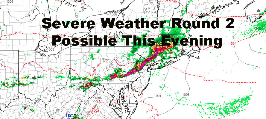
This evening, another area of convection moves through. Once again, sunshine will not play a role for our area as far as determining whether storms develop or not. Unlike yesterday where we had a cluster of individual cells move through, giving different areas different experiences (some no storms at all), this area of energy has the potential to form up a pretty sizable line.
Like yesterday, the Storm Prediction Center has us out of the “enhanced” risk area for severe weather, but due to the nature of these convective areas and direction of travel, I’m telling my listeners to keep an eye to the sky and radar. The largest threat with these storms will once again be large hail, strong winds, frequent lightning, and the possibility isolated tornados. We’ll also add localized flooding into the mix since parts of the area already have saturated ground, and there is the potential for more widespread and better organized heavy rain.
All we can do is wait and watch. Where the storms set up, where they go, and if they can make it here intact, are all factors in the game we play each time there is a threat.
REGIONAL RADAR

For tomorrow, we play the sun and clouds game again, with highs in the upper 70’s to low 80’s. This is all sunshine-dependent, and we could notch up a few extra degrees if we get some extra sun. We’ll have one more round of showers and storms possible between late afternoon and night, but I think we lose a little bit of the spark we had yesterday and will have tonight. Depending on how concentrated they are though, localized flooding could be an issue with the rain we’ve had and will get.
Friday remains looking sunny and gorgeous, with a steady NW flow and dry day rain-wise and humidity-wise. Highs remain looking like they’ll stick around the 75-80 realm.
LOCAL RADAR NEW YORK CITY

Over the weekend, Saturday is looking like a solid carry-over from Friday, with sunny skies and upper 70’s to low 80’s. Sunday also remains looking iffy but seasonal. We’ll have clouds in the area, a slight chance of some showers, but we’ll still climb up into he 70’s.
LOCAL RADAR PHILADELPHIA


MANY THANKS TO TROPICAL TIDBITS FOR THE USE OF MAPS
Please note that with regards to any tropical storms or hurricanes, should a storm be threatening, please consult your local National Weather Service office or your local government officials about what action you should be taking to protect life and property.