NYC Mid-Holiday Heat Today Beautiful Tomorrow
Good morning everyone. We have a very warm to hot one on our hands today; a taste of summer in NYC a little less than a month before summer officially begins. We could also have some locally heavy boomers around later, adding to the ambiance of what summer should be. That’ll help clear the air for tomorrow, then the gloom monster returns for a 1 day poke in the eye, but your plants will love the break.
SATELLITE

For today, we dial up that heat pretty well, helping the NYC area bake in early July glory. We are noticeably more humid today as dew points have crept up, but I wouldn’t call it oppressive with dew points in the upper 50’s to low 60’s as you’re waking up. However, light westerlies will assist in getting us to near 90, possibly over the 90 lip in some spots today.
If we do break 90, downtown Brooklyn and central Queens have the best shot. Either way, its going to be very warm to hot today, so if you’re going to be outdoors, treat it like you would a summer day 2 months from now and take proper precautions. Along the immediate shore, remember that it’s still May and the water is still cool/cold. That’ll help keep temps down into he upper 70’s to low 80’s. Cooler yes, but still a beautiful day.
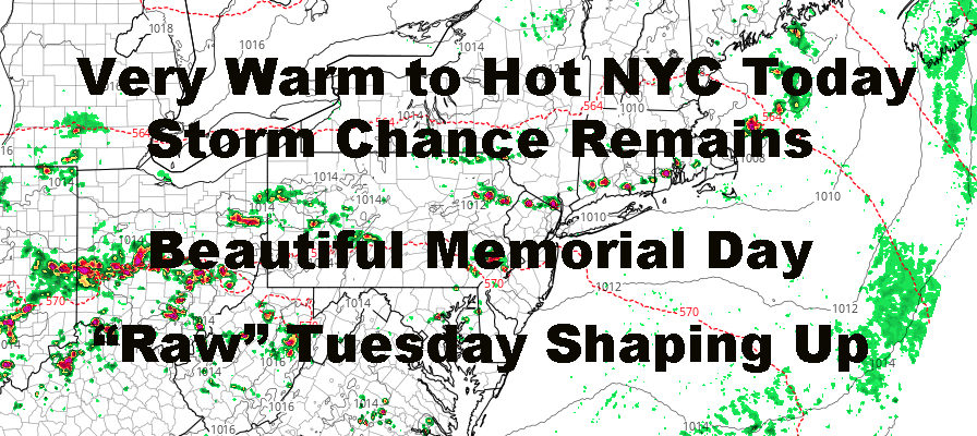
Between 5-8pm today, we also have the chance of some thunderstorms that may pop up. As this point, all we can do is watch the radar, see where they pop, and where they drift. The sun will help destabilize the atmosphere, but I wouldn’t go as far to say that we have a juicy atmosphere to work with. That being said, a summer day is summer day. and we should still treat it with respect. Any individual cell could be locally heavy/severe, with frequent cloud-to-ground lightning, torrential rain, gusty winds, and pea-sized hail, especially N&W of the NYC area.
Sunny skies and light northerlies rule for tomorrow, a perfect Memorial Day if there ever was one. Highs in the upper 70’s to low 80’s and low humidity will help things feel very comfortable.
REGIONAL RADAR

Overnight tomorrow, the gloom monster slowly creeps in as winds quietly switch around to the east. Highs pressure drifts off the coast and helps pump in that maritime air for a 1 day encore. I don’t think we climb out of the mid 60’s on Tuesday, and we’ll also have the chance of showers. It won’t be anywhere near like Mother’s Day, but it’ll feel gloomy compared to today and tomorrow.
LOCAL RADAR NEW YORK CITY

For now, it looks like we recover on Wednesday as near 80 temps and peeks of sun return, then a warm front passes through Wednesday night with some showers and storms possible. We’ll have another taste of summer on Thursday with a cold front sitting to our west; then the familiar chance of a storm and Friday could be shaping up like our Monday with dry and comfortable temps.
LOCAL RADAR PHILADELPHIA


Overall, we have a very typical late spring pattern developing and I’m very happy about how the second half of my May outlook from April unfolded. As soon as we broke out of that rut with cut-off lows and stationary fronts, we dried out fairly well and rebounded nicely temp-wise.
Enjoy the rest of your holiday weekend and remember what this weekend is about. Thank You to our servicemen and women who made the ultimate sacrifice, and may their families left behind have a peaceful day.
MANY THANKS TO TROPICAL TIDBITS FOR THE USE OF MAPS
Please note that with regards to any tropical storms or hurricanes, should a storm be threatening, please consult your local National Weather Service office or your local government officials about what action you should be taking to protect life and property.