
Weather in 5/Joe & Joe Weather Show Latest Podcast
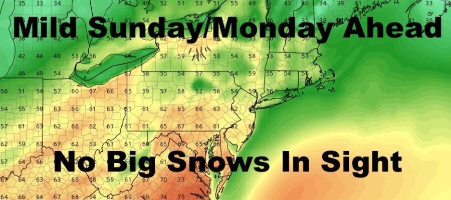
NYC Mild Today Tomorrow Big Snows Elude Area
Good morning everyone and happy Saturday! Clouds have entered the picture with mild air on the move into our region. The airmass won’t make it into the area today, but we will go mild tomorrow and Monday. It’ll come at a cost though with some scattered showers each day, then we cool off again. As of now, we continue to not see any major late season snows. We’re keeping an eye on a disturbance next weekend for the chance of some frozen precip, but it’s too early to tell what the deal is yet.
SATELLITE

Expect clouds to remain in the area today, and it’ll feel chilly with highs only in the mid 40’s. Overnight we stay steady or only drop a few degrees.
Tomorrow is complicated as far as how mild we go and where. Clouds will be in the area as well as scattered showers. If we see some blue patches or extra sunshine, near 70 temps are possible away from the coast. Best chance for seeing this would be downtown Brooklyn and areas just west of NYC. Strong southwest winds will keep Long Island much cooler. I’m staying conservative for now, and calling for 60-65 degree temps throughout much of the area, with 50’s at the immediate shore.
WEATHER RADAR

Look for more of the same Monday, with clouds and scattered showers around. Expect 60-65 degree temps, maybe some upper 60’s if we see some blue patches. Cooler at the shore.
Temps drop back to near 50 for the rest of the week, with some scattered showers possible late week.

BE SURE TO DOWNLOAD THE FREE METEOROLOGIST JOE CIOFFI WEATHER APP &
ANGRY BEN’S FREE WEATHER APP “THE ANGRY WEATHERMAN!

MANY THANKS TO TROPICAL TIDBITS & F5 WEATHER FOR THE USE OF MAPS
Please note that with regards to any severe weather, tropical storms, or hurricanes, should a storm be threatening, please consult your local National Weather Service office or your local government officials about what action you should be taking to protect life and property.