NYC NEW YEARS OUTLOOK
NYC NEW YEARS OUTLOOK
NYC NEW YEARS OUTLOOK – Merry Christmas and Happy Hanukkah everyone! Welcome to a special holiday forecast, I hope everyone has had a safe and happy holiday so far. Today is going to be a beautiful day, with sunny skies and highs in the upper 40’s to near 50 degrees. We continue to have an active pattern in the lower 48 states, which will continue to be a player in the NYC area as well. Clouds increase tomorrow, with an east wind ahead of a warm front, giving us a damp and chilly feel as the sun fades away behind the clouds; highs in the low to mid 40’s. The chance of rain will increase as we go later into the day and into the night, with some steady rain near midnight tomorrow as the warm front transits the area. Temps will rise to near 50 overnight tomorrow as we wait for the cold front to arrive. On Tuesday, we’ll probably reach our high temps no later than noon, with highs in the mid 50’s, but cooling off quickly when the cold front passes and another period of rain in the morning. Partial clearing will commence and the sun will be out before sunset on Tuesday with a gusty west wind.
Wednesday will be sunny with highs in the low 40’s as cool air moves back in and we await yet another system for Thursday. Lows will get into the low 30’s Wednesday night as clouds increase. Cold air may lock in temporarily and give us the slight chance of some wet flakes mixed in with rain Thursday morning, before changing to all rain Thursday afternoon, highs in the mid 40’s.
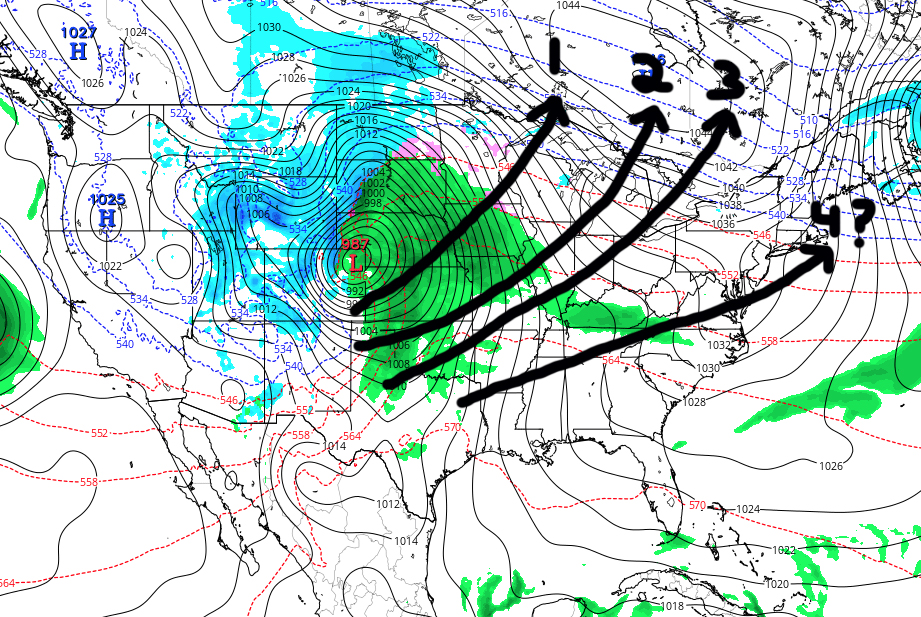
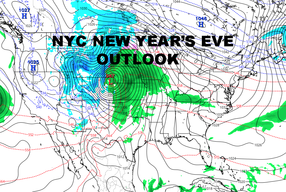
NYC NEW YEARS OUTLOOK – Over the start of New Year’s weekend, the NYC is looking chilly, with highs Friday and Saturday in the mid to upper 30’s. New Year’s eve itself won’t be as bad as it could be for Late December/early January, but it’ll still be below freezing, with lows in the upper 20’s to near 30 degrees. Make sure you bundle up if you’re going to Times Square to see the Ball drop. On New Year’s Day, warmer air begins to move in temporarily ahead of another potential system. Highs Sunday and Monday have the potential to be well above normal, but we’ll have to see what the exact track of the system is. The map above depicts my gut feeling on what’s going on. The models themselves may as well get a viking funeral right now. However, through the errors you can see a pattern brewing, a progression of systems trending eastward. In the past, this is generally a harbinger of a potential big system and a cold shot for the Northeast corridor. We’ll have to wait and see after New Year’s what this means and how it’ll play out. That being said, an extended period of warm weather is unlikely and a cold shot of air is becoming more likely down the road, while the parade of systems continues from west to east.

NYC NEW YEARS OUTLOOK – Satellite shows us once again in between two systems, with sunny skies today and increasing clouds tomorrow as our next weather-maker heads in tomorrow eve/night.

Radar is spotless locally and the NE Corridor, giving us a sunny and dry Christmas Day

FiOS1 News Weather Forecast For Long Island
FiOS1 News Weather Forecast For New Jersey
FiOS1 News Weather Forecast For Hudson Valley
NATIONAL WEATHER SERVICE SNOW FORECASTS
LATEST JOESTRADAMUS ON THE LONG RANGE

Weather App

Don’t be without Meteorologist Joe Cioffi’s weather app. It is really a meteorologist app because you get my forecasts and my analysis and not some automated computer generated forecast based on the GFS model. This is why your app forecast changes every 6 hours. It is model driven with no human input at all. It gives you an icon, a temperature and no insight whatsoever.
It is a complete weather app to suit your forecast needs. All the weather information you need is right on your phone. Android or I-phone, use it to keep track of all the latest weather information and forecasts. This weather app is also free of advertising so you don’t have to worry about security issues with your device. An accurate forecast and no worries that your device is being compromised.
Use it in conjunction with my website and my facebook and twitter and you have complete weather coverage of all the latest weather and the long range outlook. The website has been redone and upgraded. Its easy to use and everything is archived so you can see how well Joe does or doesn’t do when it comes to forecasts and outlooks.
Just click on the google play button or the apple store button on the sidebar for my app which is on My Weather Concierge. Download the app for free. Subscribe to my forecasts on an ad free environment for just 99 cents a month.
Get my forecasts in the palm of your hand for less than the cost of a cup of Joe!
