
Weather in 5/Joe & Joe Weather Show Latest Podcast
NYC Period of Light Snow Possible Tomorrow
Good morning everyone. We’re off to a beautiful start in the mid 50’s this morning, and temps will remain pretty much steady or creep up a few degrees. Tomorrow and Monday will be the hiccup in our “warmer” pattern as we have the chance of some light snow tomorrow, then a very cold day on Monday. Things will modify fairly quickly, and we have a fairly quiet week till Friday.
SATELLITE

Look for sunshine today, then increasing clouds late. Highs will be in the mid to upper 50’s. Clouds increase overnight, and depending on when the precip starts (if anything at all), it might start out as some drizzle or light rain before changing to light snow.
WEATHER RADAR

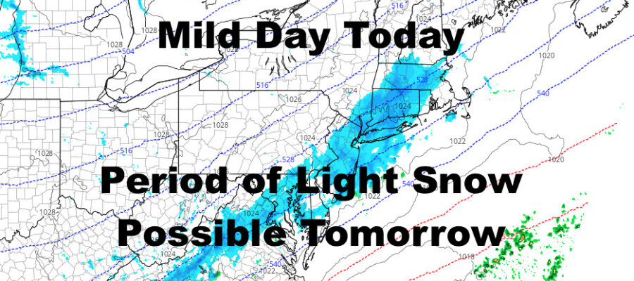
If that precip is even able to form, we’ll have some light snow starting between 5 and 8am, then lasting till late morning/early afternoon. The max we’ll see out of this will be a dusting to 2″. Best chance to see the higher end of the spectrum (and I stress the word “chance”), will be the east end of Long Island. Highs will be in the low 30’s tomorrow.
Expect a cold and sunny one on Monday, with highs only in the upper 20’s.

We modify quickly with highs in the upper 30’s on Tuesday, then low to mid 50’s by Wednesday. Depending on the timing of our next system, we might start the rain on Thursday, but could see some low 60’s if the rain holds off a bit. Best chance for some heavier showers, will be on Friday with a breezy/windy mid 50’s.
BE SURE TO DOWNLOAD THE FREE METEOROLOGIST JOE CIOFFI WEATHER APP &
ANGRY BEN’S FREE WEATHER APP “THE ANGRY WEATHERMAN!

MANY THANKS TO TROPICAL TIDBITS & F5 WEATHER FOR THE USE OF MAPS
Please note that with regards to any severe weather, tropical storms, or hurricanes, should a storm be threatening, please consult your local National Weather Service office or your local government officials about what action you should be taking to protect life and property.