NYC Potentially Misses Lowest Recorded Snow Amount Record
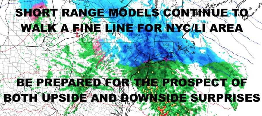
Good morning everyone. As we get closer to our potential snow event later tomorrow and overnight tomorrow night, we continue to paint a cautionary tale about this type of system and overrunning precip. This one in particular will have the potential to have both upside surprises and complete busts, so we will discuss all the options on the table and the scenarios that may play out. What makes it even more complicated, is our lack of winter conditions this year and milder than average ocean temps.
SATELLITE
For today, we start off with clouds and should see some blue breaks late. Expect highs near 50 for a mild day. Overnight, lows sneak down into the upper 20’s to low 30’s as cold air tries to wedge itself in.
That’ll help set us up for a potentially wintry’ish scenario tomorrow afternoon as our next system approaches. Overrunning moisture will clash with relatively colder air as we get into the upper 30’s to low 40’s tomorrow. Colder air in the midlevels of the atmosphere will try and hold on, but low pressure will be off to our north and west, making things more difficult. Low pressure will try and transfer energy to the coast. If this happens soon enough and our secondary wave is strong enough, it could lock the cold air in long enough for a prolonged period of snow and/or mixed precip. While things look to remain all or mostly snow N&W of the NYC area regardless of whether this transfer happens soon enough or strong enough, the transfer will be more crucial for NYC and Long Island.
At the moment, I remain very conservative on this, but acknowledge that the potential for an upside surprise is there. For areas N&W of the NYC area, expect a 4-8″+ snowfall out of this, with potentially higher amounts (6-12″+) in higher elevations and if that secondary low winds up being a little bit more vigorous.
For the NYC area, look for a coating to 2″ possible. Remember, temps will be above freezing during this, so accumulations (if any) will mostly occur on colder surfaces such as trees, grass, and cars. It’ll have to come down at a more intense rate to accumulate on the streets or accumulate faster on colder surfaces during the onset. For Long Island, the South Shore has the biggest potential for a bust due to its proximity to the milder ocean. Right now we will keep the area in the dusting to 1″ range. Along the North Shore and North Fork, we’ll bunch them in with NYC with a coating to 2″. We could also see several transitions between snow and rain depending on the intensity of the precip. Heavier rain will cool the atmosphere and change things back to big wet flakes, then drizzle as things get lighter.
Now let’s talk about upside and “best case scenario” for snow lovers. If enough cold air is trapped, if that secondary low can get going, and if the precip winds up being heavier, we could see a 2-4/3-5″ scenario play out for the NYC area and the North Shore of Long Island. That’ll put the South Shore in a 1-3″ type snowfall before mixing with and turning to rain.
Again, this is a complicated forecast and system, and nothing is locked in.
WEATHER RADAR
Snow, mixed precip, or rain will taper off on Tuesday, and anything that does accumulate will melt between Tuesday’s 40’s & Wednesday’s near 50 temps w/ sunshine.
Clouds increase again on Thursday with our next system starting to stretch its legs, and we should see 55-60 degree temps.
BE SURE TO DOWNLOAD THE FREE METEOROLOGIST JOE CIOFFI WEATHER APP &
ANGRY BEN’S FREE WEATHER APP “THE ANGRY WEATHERMAN!
MANY THANKS TO TROPICAL TIDBITS & F5 WEATHER FOR THE USE OF MAPS
Please note that with regards to any severe weather, tropical storms, or hurricanes, should a storm be threatening, please consult your local National Weather Service office or your local government officials about what action you should be taking to protect life and property.


