NYC Saturday Snow Rain Scenario Continues
Good morning everyone. Much colder air is setting up to make its grand entrance soon after we get rid of these morning clouds. That’ll help set us up for a cold and windy day tomorrow, then Saturday’s overrunning moisture and some snow to start. Cold air returns behind our weekend system, then we look to next weekend for our next chance of precip after a cold and dry week.
SATELLITE

Look for clearing skies today, and we’ve pretty much reached our highs in most areas. Expect upper 40’s to begin to drop, especially towards mid to late afternoon as a strong, gusty breeze develops. Lows tonight will dip to the low 20’s, and some areas N&W of NYC and the Pine Barrens of Long Island could see some teens.
REGIONAL RADAR

Cold and wind continue tomorrow, and we struggle to reach the upper 20’s to low 30’s as highs. We’ll remain dry, but winds gusts could push the 45-50mph mark at times. Lows again will be in the low 20’s in NYC proper, and a better chance of teens N&W of NYC and a bigger swath of Long Island.
LOCAL RADAR NEW YORK CITY

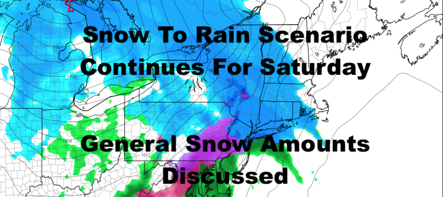
Saturday remains complicated but we’re starting to hone in on timelines and snow amounts before things switch over to a mix, then rain. Snow should begin some time between noon and 3pm in the NYC area, and we can adjust that if need be. By then, temps will be above freezing, so any accumulating snow will primarily be on colder surfaces (cars, trees, grass, wood decks, etc).
Taking the speed of our system, our temps by the time snow begins, and our changeover to a mix then rain, I’m going with a trace – 2″ unless anything shocks me tomorrow. I’m also leaning towards the lower end of that spectrum until I see the final setup as our radar begins to light up and I see how the layer of cold air looks. For us here, the changeover to rain, and above freezing temps overnight Saturday and Sunday, will wash it all away.
North and west of the NYC area, I’m going with a general 2-4+” of snowfall. The “+” is for the higher elevations and for those where cold air gets trapped locally before any changeover to mix or precip ends. Again, we’ll have to see the final radar setup, and I’m going with the lower end of this spectrum for now, especially as you get closer to the NYC area and coast.
LOCAL RADAR PHILADELPHIA


Sunday is looking sunny, breezy, and cool, with highs near 40 in most spots; then we drop to near 20 overnight as cold air rushes in for the week. The week itself is looking cold and dry, then we’ll be watching our next system next weekend, which I’m not even discussing at the point because it’s too far away.
MANY THANKS TO TROPICAL TIDBITS FOR THE USE OF MAPS
Please note that with regards to any tropical storms or hurricanes, should a storm be threatening, please consult your local National Weather Service office or your local government officials about what action you should be taking to protect life and property.