
Weather in 5/Joe & Joe Weather Show Latest Podcast
NYC Tropical Moisture Impacts Late Week Forecast
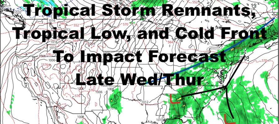
Good morning everyone. We have a very warm day about to unfold here in the NYC Metro Area, and we’ll be keeping an eye on all the ingredients coming together for a wet forecast late Wednesday into Thursday. That’ll pretty much be the only hiccup in this forecast, then we return to nice weather for Friday and the weekend.
SATELLITE

Today is an easy one ahead of our cold front that’ll drop down from the north. Look for a mix of sun and clouds, humid conditions, and highs in the upper 80’s to near 90.
Tomorrow, we’ll be on the other side of that front, and onshore winds will help keep things near 80 with a cooler feel on the skin.
WEATHER RADAR

Clouds increase Wednesday, but warmer air will have snuck in for an encore. Before we get started on the rain, expect upper 80’s in spots, especially in downtown Brooklyn and central Queens. Overnight, some showers may move in, and we’ll have to keep an eye on the exact timing.
This is all in conjunction with an approaching cold front, the remnants of Nicholas, and a tropical wave heading in from the SE region. We could see some widespread showery conditions on Thurs, some of which may be heavy at times. We’re not talking anything like Ida’s remnants, but again, it won’t take much to cause problems due to all of the rain we’ve had.

Look for partial clearing on Friday with upper 70’s to low 80’s, then a beautiful weekend with sunshine and low to mid 80’s.
BE SURE TO DOWNLOAD THE FREE METEOROLOGIST JOE CIOFFI WEATHER APP &
ANGRY BEN’S FREE WEATHER APP “THE ANGRY WEATHERMAN!

MANY THANKS TO TROPICAL TIDBITS & F5 WEATHER FOR THE USE OF MAPS
Please note that with regards to any severe weather, tropical storms, or hurricanes, should a storm be threatening, please consult your local National Weather Service office or your local government officials about what action you should be taking to protect life and property.