
Weather in 5/Joe & Joe Weather Show Latest Podcast
NYC Two Final Systems Before Pattern Slowly Breaks Down
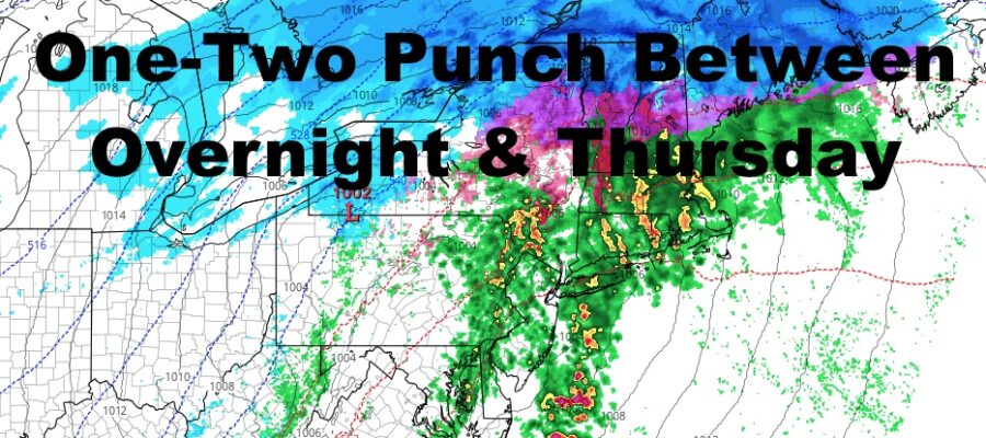
Good afternoon everyone. We have a busy 3 days ahead with a wide range of conditions affecting the Northeast in a short scope of miles, but once we get past Thursday, things begin to slow down a bit. Let’s get to it and explain all of the nuances (and annoyances).
SATELLITE

First up to the plate is our vigorous system that’s wreaking havoc in the lower Midwest and Gulf states. That’ll help spread some light mixed precip and light rain well ahead of it today, then heavier precipitation moves in overnight.
For the NYC area, it looks as if this thing is a brief mix to rain, heavy at times-type system. However, interior parts of the Northeast, especially NW NJ, NE PA, and the Catskills area of NY, we have a big freezing rain problem brewing. Expect a prolonged period of freezing rain in these areas overnight and early tomorrow morning, with possibly .10-.40 of ice accumulation. This will be enough to cause major problems in the ice storm and winter weather advisory areas.
Expect the possibility for downed tree limbs and power lines as everything unfolds. For many of these spots, we should see a brief changeover to rain before everything ends, but the damage will be done and tomorrow morning’s commute will be a mess. My suggestion is to stay completely off of the roads and stay at home. No regular vehicle is equipped to deal with ice, and this is when you see those 20, 30, 100 car pile-ups.
For NYC and Long Island, we’ll be in the mild sector of this system, with highs briefly in the 45-50 range, and don’t be surprised if you hear a rumble of thunder as the font passes by.
F5 WEATHER RADARS

Wednesday we clear out and colder air heads in behind tomorrow’s system. Look for mid 30’s during the day, then mid 20’s overnight, setting us up for our next system.

Thursday will be an insult to injury to some of these areas that saw freezing rain, but here in NYC, we may get in on some of the wintry action too. I’m holding off on making the call yet, but we may see a brief “thump” of snow here before things begin mixing and end as a cold rain. Depending on how brief or how long (if any at all) that period of snow is, will determine if we see a 1-3″ or 3-6″ type snowfall before things get slushy and/or wash away with the rain.
We may see some AM sprinkles Friday, but overall we begin to dial back the constant action. We won’t be precipitation free, but we will see more breathing room as the precession slows down and weakens.
BE SURE TO DOWNLOAD THE FREE METEOROLOGIST JOE CIOFFI WEATHER APP &
ANGRY BEN’S FREE WEATHER APP “THE ANGRY WEATHERMAN!

MANY THANKS TO TROPICAL TIDBITS & F5 WEATHER FOR THE USE OF MAPS
Please note that with regards to any severe weather, tropical storms, or hurricanes, should a storm be threatening, please consult your local National Weather Service office or your local government officials about what action you should be taking to protect life and property.