Summer Weather Pays One Day Visit to New York City
04/29/24 9:54am ET
Good morning everyone. We had another rough night with severe weather in the lower Midwest and Gulf Coast, and the action continues this morning as everything slides towards New Orleans and the Bayou. We watched clusters of tornadic storms morph into a self-contained thunderstorm complex, then trudge east/southeast towards the Texas and Louisiana coast. Widespread damage and flooding have been reported throughout the region.
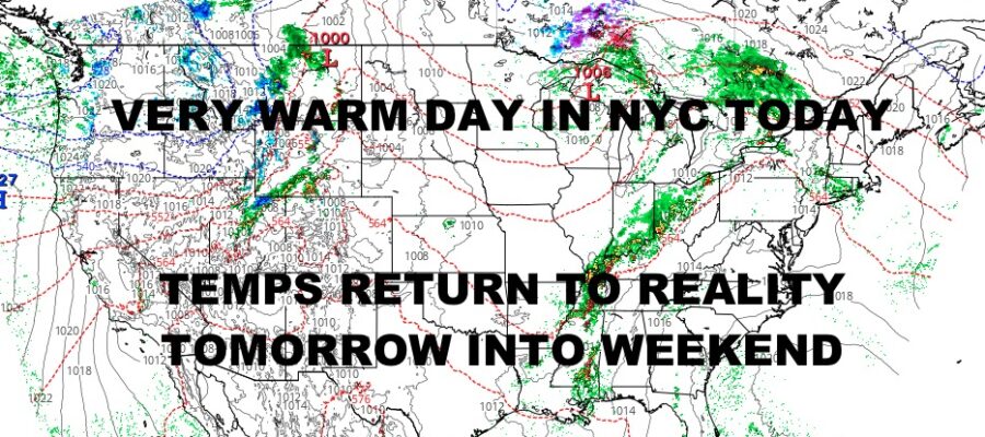
For the Northeast, things remain calm and it’ll be a very warm one today. The record high for NYC on April 29th, set in 1974, is 89 degrees. I don’t think we quite get there, but it’ll be close and other areas could see upper 80’s if the wind cooperates. It’ll be a drastic change tomorrow as temps return back to reality and in the 65-70 degree range for most of the region.
Aside from the 1 day summer visit in the NYC area, the big story remains our ongoing severe weather and severe weather prospects tonight. Over the next couple of hours, we will see maturing and dying storms head into the New Orleans area and will probably be accompanied by a fairly sizable gust front as the storms blow themselves out. While severe thunderstorm watches are starting to thin out, marine warnings and severe thunderstorm warnings remain viable for 55+ mph winds, large hail, waterspouts, and isolated tornadoes.
As that action dies out, leftover energy will provide enough gasoline later tonight to introduce more severe weather potential. Between 11pm and 1am, look for clusters of storms to blossom in areas such as western Kentucky, western Tennessee, the Illinois & Indiana border or Kentucky, and parts of Mississippi. These clusters will organize into a new line, then move through central Tennessee and Alabama in the overnight hours into early tomorrow morning.
Look for new watches and warnings to pop up as our line of storms will be capable of producing large hail, damaging winds, frequent lighting, flooding rain, and tornadoes. Please stay tuned to your local agencies for the latest watches and warnings; and again, be prepared to take action in order to protect property and life.
Here is your local NYC Metro forecast –
SATELLITE

Look for sunshine today, light NNW winds, and highs in the mid to upper 80’s. Our cooler air on the move could touch off a widely scattered thunderstorm later this afternoon. The best chance to see some upper 80’s, will be in the Newark area, as well as central Brooklyn and areas of central/northern Queens.
WEATHER RADAR

Clouds roll in tomorrow, but we stay dry for much of the day. Highs will be much cooler and in the mid to upper 60’s. We could see a few showers on Wednesday with extra clouds, and highs remain in the 60’s.

Some sun returns on Thursday as we should reach 70, then we do it again on Friday for a carbon-copy day.
BE SURE TO DOWNLOAD THE FREE METEOROLOGIST JOE CIOFFI WEATHER APP &
ANGRY BEN’S FREE WEATHER APP “THE ANGRY WEATHERMAN!
MANY THANKS TO TROPICAL TIDBITS & F5 WEATHER FOR THE USE OF MAPS
Please note that with regards to any severe weather, tropical storms, or hurricanes, should a storm be threatening, please consult your local National Weather Service office or your local government officials about what action you should be taking to protect life and property.