Sustained Late Spring Air in New York City
05/30/24 11:30am ET
Good late morning everyone. We have a lot going on and a lot of land to cover as good news finally spreads into the Northeast; while bad news continues for the Midwest and South.
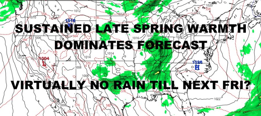
Highs pressure looks to dominate a big stretch for the East Coast, including the NYC Metro area where we could go 7-8 days without any organized rain. On top of it all, the big story out there will be sustained spring air instead of temps below average. Things climb gradually the next 2 days, then we are a seasonable near 80 for a long stretch; something we haven’t seen in a while.
For the Midwest, we have leftover heavy showers and thunderstorms from last night’s action. Flooding rain and loud rumbles dot the area in clusters, from North Dakota, South Dakota, Nebraska, Kansas, Oklahoma, all the way down in Texas. While we do have some embedded severe weather with some severe thunderstorm warnings, there are no official severe thunderstorm watches at this time.
However, things will change later this afternoon on into this evening and tonight. That energy, combined with the heating of the day, will provide enough fuel for this storms to erupt into several severe clusters of storms. Including the possibility of a Derecho-type system in central Texas that will race south and east. A “Derecho” is a type of thunderstorm complex that covers hundreds of miles, is long-lived in terms of how far they travel before fizzling out, and has winds capable of 70+ mph for an extended amount of time. They are also capable of very large hail and isolated tornadoes.
Even if we don’t see a Derecho out of this, areas that do see severe weather, will be at risk for very large hail, damaging straight-line winds, frequent lightning, flooding rain, and strong tornadoes. Areas included in this discussion, will be Minnesota, South Dakota, Iowa, and down into Nebraska in a scattered line; then Oklahoma, Kansas, Texas, and Arkansas for the organized clusters of severe weather.
Please stay tuned to your local agencies for the latest watches and warnings. Things look to go downhill rather quickly in spots where ordinary showers and storms will grow out and get more intense as the day wears on.
SATELLITE

Look for a mix of sun & clouds today and cooler temps as low pressure off the coast enhances the maritime flow. It’ll still be pleasant though, with highs in the low 70’s. Tomorrow is an absolute winner, with full sunshine and highs 75-80.
WEATHER RADAR

Your first weekend in June is also a winner, with full sunshine Saturday and highs in the upper 70’s to low 80’s. Look for more of the same on Sunday, with clouds and sun and carbon-copy temps.

The start of your workweek next week remains warm and dry, with sunshine Monday & Tuesday and highs in the near 80/low 80 range.
BE SURE TO DOWNLOAD THE FREE METEOROLOGIST JOE CIOFFI WEATHER APP &
ANGRY BEN’S FREE WEATHER APP “THE ANGRY WEATHERMAN!
MANY THANKS TO TROPICAL TIDBITS & F5 WEATHER FOR THE USE OF MAPS
Please note that with regards to any severe weather, tropical storms, or hurricanes, should a storm be threatening, please consult your local National Weather Service office or your local government officials about what action you should be taking to protect life and property.