
Weather in 5/Joe & Joe Weather Show Latest Podcast
Tropical Storm Henri Makes Landfall & Westward Turn
Good afternoon everyone. Tropical Storm Henri passed just east of Montauk point, somewhere at or in between Block Island and Montauk, then went into the Watch Hill area of Rhode Island. For those unfamiliar with the area, Watch Hill is essentially on the border of RI and CT. It’s still packing a punch close to it’s center with tropical storm force winds, but for us, heavy rain & flooding is the main focus now.
SATELLITE

Thankfully Henri made this turn about 20-40 miles “too late”, because we’d have a different situation here had it was about to do so earlier. Connecticut is bearing the brunt right now, but upstate NY in the lower Hudson Valley will be getting into some heavy rains and gusty winds soon.
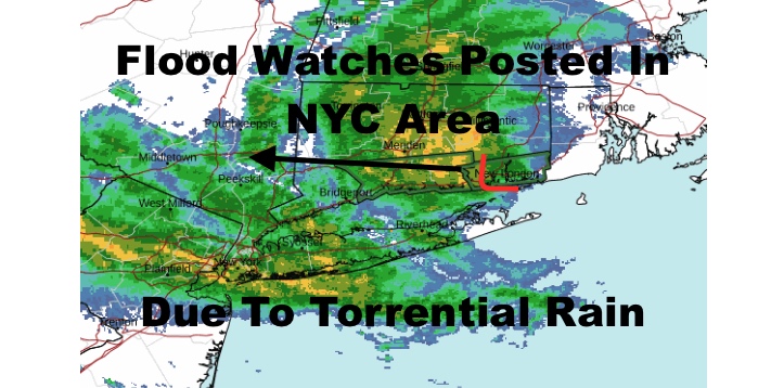
WEATHER RADAR

For us here in NYC and Long Island, Nassau County and the 5 boroughs is seeing the bulk of the rain as that trough and Henri combine and keep the tropical moisture reoccurring over the same areas. This will equate to the potential for flooding rains and flash flooding across the area. Winds are not really an issue here, but any isolated gusts as Henri moves west, could push some weak trees down in spots. The threat for power outages locally is low, but they may occur in spots, especially in the lower Hudson Valley.

Storm surge remains an issue for the Long Island Sound, but the next high tide at night will be less of an issue than this morning. The south shore of NYC and Long Island is out of the woods as far as any threat for storm surge.
BE SURE TO DOWNLOAD THE FREE METEOROLOGIST JOE CIOFFI WEATHER APP &
ANGRY BEN’S FREE WEATHER APP “THE ANGRY WEATHERMAN!

MANY THANKS TO TROPICAL TIDBITS & F5 WEATHER FOR THE USE OF MAPS
Please note that with regards to any severe weather, tropical storms, or hurricanes, should a storm be threatening, please consult your local National Weather Service office or your local government officials about what action you should be taking to protect life and property.