Weather in 5/Joe & Joe Weather Show Latest Podcast
Tropical Update Henri Strengthens Achieves Hurricane Status
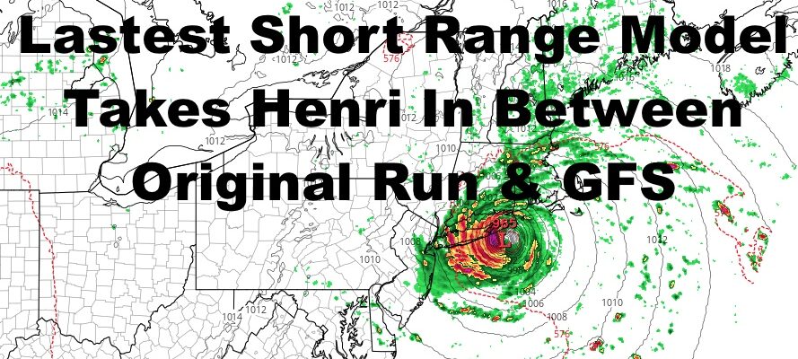
Good late morning everyone. Tropical Storm Henri has now become Hurricane Henri and continues to push in our general direction. The latest short range model run begins to take the center of Henri further east towards Hampton Bays. If you take a took at my morning forecast, we discussed that the system would probably make landfall in between this morning’s model run and the GFS idea of between Montauk and Rhode Island. Things are leaning in that direction, and there is still a window for a wobble east or west.
SATELLITE
This is why it’s important to continue to prepare regardless of the outcome, and tune out any irresponsible outlets already calling Henri a “dud”. For someone, it won’t be, and to give a false sense of security is outright dangerous.
Continue to prepare for power outages, downed trees, and coastal flooding in areas that flood easily. Again, if you had flooding during Irene, you need to watch this system closely and take action now to protect property. With leaves on the trees and what will be a saturated ground, some trees will fall easily regardless of whether the winds are sustained at 50mph, or gusting to 50mph during rain bands.
If you didn’t have flooding in Irene in NYC and the south shore of Nassau and western Suffolk, you are relatively safe from the surge part of this system. If you did have flooding, you need to take notice.
For those who didn’t experience Irene’s effects, such as the Long Island sound and the Forks, listen to your local administrators, not amateurs, as far as what action you need to take to protect life & property. Regardless of where Henri makes landfall, the Sound and Eastern Suffolk will experience a 2-4/3-5ft storm surge. This is not Sandy territory, but it is Irene territory and some damage will occur.
WEATHER RADAR
One thing is very important to remember, when dealing with approaching tropical systems, the ocean and surge don’t magically calm down when a system weakens by 10-20mph in terms of wind or doesn’t look impressive on the satellite anymore. This is approaching with a lot of energy that’ll spread out as it hits cooler water/land and weakens.
That is why it’s important not to hang your hat on whether the system is a hurricane or tropical storm.
To check out this morning’s forecast and what to expect & when, click on your copy and paste this link – https://www.nycweathernow.com/nyc-long-island-make-henri-preparations-now/
BE SURE TO DOWNLOAD THE FREE METEOROLOGIST JOE CIOFFI WEATHER APP &
ANGRY BEN’S FREE WEATHER APP “THE ANGRY WEATHERMAN!
MANY THANKS TO TROPICAL TIDBITS & F5 WEATHER FOR THE USE OF MAPS
Please note that with regards to any severe weather, tropical storms, or hurricanes, should a storm be threatening, please consult your local National Weather Service office or your local government officials about what action you should be taking to protect life and property.


