DOWNLOAD MY NEW FREE JOESTRADAMUS WEATHER APP FOR ANDROID
THE APP IS ABSOLUTELY FREE TO ALL BUT CONSIDERING SUBSCRIBING TO PATREON FOR A WEATHER EXPERIENCE FREE OF ADS, EXCLUSIVE VIDEOS FOR MEMBERS ONLY AND MUCH MORE…STARTS AT $2 A MONTH..MESSAGE ME AT ANY TIME
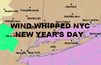
WIND WHIPPED NYC NEW YEARS DAY
Good morning everyone and Happy New Year! If you were planning on enjoying a warm day here in the New York City area, the temps we are seeing at 7am are your highs for today and that’s that. Winds are already picking up and cool air is about to settle back in.
EASTERN SATELLITE

Expect morning clouds then clearing as the day wears on. Your upper 50’s this morning will be replaced with 40’s by afternoon and we have wind advisories/gale warnings posted. Look for steady 15-25mph winds switching over to the WNW, and gusts as high as 50mph possible in spots.
Overnight, the wind continues and we sink into the mid to upper 20’s.
REGIONAL RADAR

Tomorrow, we’ll have sunny skies, much lighter winds, and a spot-on seasonable day with highs in the mid 30’s. Overnight tomorrow, that disorganized system expected to brush us Thursday should arrive slightly earlier. With it, there’s a slight chance it could touch off some light snow showers, mixing with rain as we get close to sunrise.
For Thursday, the chance for some spotty mixed-precip continues early in the morning, then some spotty light showers possible until midday; highs in the upper 30’s to low 40’s.
I’ll be keeping a close eye on this as it has the potential to not materialize at all, not even widely scattered precip.
LOCAL RADAR NEW YORK CITY

Unfortunately, this weak system clears the path for another rain-maker this weekend. As of now, we’ll have a sunny Friday with increasing clouds late; highs in the low to mid 40’s. Then overnight Friday, rain will move in before sunrise and continuing into Saturday.
As of now, Sunday looks to be the better of the two days with sunny and breezy conditions, highs in the low to mid 40’s.
LOCAL RADAR PHILADELPHIA


In the long range, our pattern continues to look hostile towards any big snow-makers. The very cold air is there, waiting and willing to come down from Canada; but we have nothing to bring it down as of this moment. So for now, seasonal to slightly above average (not warm by any longshot) temps continue onward.
Mid January continues to have the potential for some below average temps, but how long it lasts is in question. I still don’t feel we wind up with a snowless January, but we’re gonna have some catching up to do if we remain snow free through mid-January or later.
MANY THANKS TO TROPICAL TIDBITS FOR THE USE OF MAPS
Please note that with regards to any tropical storms or hurricanes, should a storm be threatening, please consult your local National Weather Service office or your local government officials about what action you should be taking to protect life and property.